Technics Receive Achilles UVDB Accreditation
Following a two-day inspection into our quality, health and safety, environmental and corporate social responsibility systems, Technics has successfully passed the Achilles audit for UVDB Verification.
Following a two-day inspection into our quality, health and safety, environmental and corporate social responsibility systems, Technics has successfully passed the Achilles audit for UVDB Verification.

We went along to the first AGI (The Association for Geographic Information) Asset Management Special Interest Group event of 2017, which looked at data standards, and specifically PAS 128 Survey (Specification for underground utility detection, verification and location) and 256 (Buried assets – Collection, recording and sharing of location information data – Code of Practice).
At Technics we aim to continuously strengthen our team through training and development and are pleased to announce the recent qualification of Property Manager Adam Harwood as a RICS Chartered Surveyor.
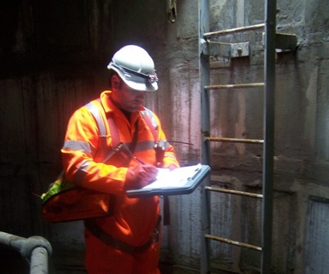
With the range of services we provide our work can often take place in very challenging environments including confined space. This is why it’s our number one priority to our employees to maintain their safety along with the people around them.
The Ordnance Survey of Great Britain (OSGB), Ireland (OSI) and Northern Ireland (OSNI) have been working together to improve the OSGM02 geoid model resulting in OSGM15. OSGB has also updated the horizontal transformation OSTN02 to create OSTN15. The horizontal transformation for Ireland and Northern Ireland is unchanged.
This evening, Martin Penney, Director at Technics and member of the Survey4BIM task force, will be attending this leading industry event, to take part in a debate on the BIG 5 Geospatial Challenges.

As part of the Smart London Infrastructure Network challenge competition, Technics is pleased to announce that it won the opportunity to pitch the Stream EM to members of the Infrastructure Network, which includes representatives from some of the largest infrastructure projects in London.
Technics’ employees showed their support for The Bobby Moore Fund for Cancer Research UK last week by wearing their favourite football shirts to the office, with donations being made by all staff members.
Our Survey Director, Martin Penney attended the illuminating Leica & Autodesk Workshop in Milton Keynes

Emma Parker, Eleanor Daly and Alicja Faryniarz took part in the ZSL London Zoo 10k Stampede last month.